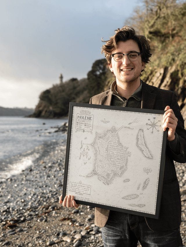
Cards on the table: a conversation with geographer Perrin Remonté
You need a map to get lost.
You need a map to get lost. A road map, preferably on paper, with its sturdy folds, outdated place names, and winding back roads. A map you unfold not because it tells you what to do, but because it quietly suggests. It doesn’t trace an ideal route. It leaves room for the unexpected, the detour, the choice to take a different path.

That’s the mindset I was in when I reached out to Perrin Remonté, whom I stumbled upon—fittingly—while getting lost between two searches on LinkedIn. Based in Brest, the westernmost city in France, he works at the crossroads of academic geography, data visualization tools, and the visual language of graphic design. We share a mutual friend: David Wahl, an author with an explorer’s flair, who, like Remonté, seeks to bring storytelling back into science, the sea, and geography.
Perrin Remonté’s maps are the opposite of GPS systems and automated navigation interfaces. They’re designed as invitations to observe the land differently. His work weaves together scientific rigor and graphic intuition, objective data and poetic sensibility. These maps don’t just represent—they tell stories.
A conversation with a geographer, cartographer, and author who likes to reveal what usually goes unseen.
Historically, how has the map shaped our perception of France?
That’s a big question, but there’s one key fact worth remembering: France was likely the first country to be mapped methodically and scientifically, thanks to the Cassini family in the 18th century. They began a precise effort of surveying and measuring—at a time when most maps were still highly inaccurate. In this sense, French cartography helped build the territory itself, fix it in place, give it a readable form.
Also, the cartographic tradition is largely military in origin. Maps were drawn to conquer, to control, to navigate. Here in Brest, where I live, there’s still the SHOM—the French Navy’s Hydrographic and Oceanographic Service—which produces nautical charts used worldwide. That’s just one example of a highly structured, institutionalized cartographic expertise.
Your work often seems to carry a message. Would you say your maps are political?
I believe all maps are political, whether we admit it or not. Even those that claim to be objective come from a particular point of view. What we choose to represent, at what scale, with which key or legend—these are all decisions.
Personally, I don’t make neutral or agenda-free maps. I pick my subjects based on what I want to make visible: population voids, hydrographic networks, density gradients, forgotten areas. My goal is to show what we don’t necessarily see—or don’t want to see. From there, people are free to interpret. The map can be a tool for empowerment, because it gives access to a situated form of knowledge. And I truly believe that knowing your environment already gives you a bit of power over it.
In contrast to algorithms, the map can also be seen as a tool for choosing a different path…
Exactly. A map opens up possibilities. It allows you to choose based on something other than speed or efficiency. It encourages detours, surprises, coincidences. And above all, it forces you to engage with the terrain. That’s why it seems more precious today than ever.
A few maps designed by Perrin Remonté
Imagining a France governed by water
The current administrative regions—especially since the 2016 reform—strike me as rather artificial. They were created for economic and administrative reasons, but they lack natural or territorial coherence. The Hydrocracy map is based on watersheds and the natural flow of water. I also worked on naming: I invented regional names inspired by local languages, landscapes, and poetic elements. It’s a way to bring meaning back into the map. The word “hydrocracy” itself is a nod to “thalassocracy”: instead of power rooted in the sea, here we imagine one based on freshwater—its management and circulation.
A geological bike tour of France
This one was about proposing a journey through time via rocks. I created a cycling route that takes you across all the geological layers of mainland France, from the oldest to the most recent. It links geology with landscapes, and also with agricultural or viticultural practices. I included stops, points of interest, and a kind of narrative thread.
Human Mountains
In this map, I used population density data to generate a fictional landscape. High population areas appear as mountain peaks; where density is low, the land becomes flat or submerged. Then I worked on the colors, the legend, and most importantly, the names. That’s where the work becomes more poetic. I like inventing place names, drawing on ancient roots, forgotten terms, and mythological references. It becomes a sensitive, literary map that also reflects my own relationship to the land.
Brest, port of the world
Today, most flows happen by air. Everything moves fast, everything’s optimized. I wanted to champion a different idea of travel—slower, more contemplative: on foot, by train, by sailboat. And Brest is a great starting point. It’s a city that faces the sea, a place of stories, explorers, scientists, sailors. I imagined fictional routes starting from the port and stretching out to the world. It’s a tribute to the golden age of sailing, maybe—but also an invitation to dream up new possible worlds.
And then one bonus question: if we make it to Brest, where do you suggest we get lost?
First, I’d recommend Océanopolis—a science center dedicated to the marine world. Then, the Plougastel peninsula, with its sunken lanes, hidden coves, and fossil reefs. These are rich but often overlooked landscapes. And if you’re looking for a place to eat, pack a picnic. There are forts, little inlets, remote spots where you can really settle in and enjoy.
Discover Perrin Remonté’s work on his website. His maps are available for purchase.


What a great post — I love maps, and the French Hydrocratie map is absolutely brilliant!! :)
A fascinating post. Fantastic/Crazy maps!...